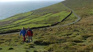
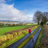
Dursey Island is located at the tip of the Beara Peninsula in Co. Cork. Access to the island is by the only cablecar in Ireland, which takes six people. The island has very few inhabitants and no shops, pubs or restaurants – thus offering a unique experience of undisturbed tranquility. Dursey is famous for its magnificent selection of bird species and is a birdwatchers’ heaven. The island has a stark and appealing beauty, with rugged indented coastline, lofty cliffs, open bog and a patchwork of fields divided by dry stone walls and ditches. The landscape is almost treeless since few parts of the island are not exposed to strong winds and salt spray. The landscape is dotted with antiquities ranging from standing stones and early monastery to an impressive signal station from the Napoleonic era. [The cablecar operates only certain periods of the day – please check timetable and allow at least 5hrs for your trip.]
A-B. Starting from the cablecar, follow the purple arrow along the roadway which travels the southern side of the island. You are also on the long-distance Beara Way marked with yellow arrows and the familiar trekking man logo. After 1km you reach Ballynacallagh the first of three villages on the island. Continue along the roadway.
B-C. Follow the roadway for a further 1km to reach the village of Kilmichael where it is said that monks from Skellig Rock founded the ancient church - now a ruin. Stay on the roadway.
C-D. Continue along the roadway for a further 3kms – and enjoy the spectacular views of the Beara Peninsula on your left. To your right runs a range of steep hills along which you will return – the Signal Station is at the highest of 252m. Within 100m of the end of the roadway, you turn right at a stone wall onto the hillside section.
[Note: You may wish to consider the option of continuing from here to Dursey Head, the westernmost point of the island.
The out-and-back journey will add 1hr-1hr30mins to your trip.]
D-E. Follow purple and yellow arrows along the well-worn track uphill – a 15min walk will take you to the impressive Signal Tower (ruins). From here you have fine views of the northern side of the island and of the west Cork coastline. Two distinctive islands to the West are named the Bull and Cow! Continue straight from the tower - careful to follow the direction of the waymarker.
E-F. The loop now begins to descend, crossing a stile and joining a ‘green’ road for approximately 500m. As you round a right bend, the loop takes a sharp left turn uphill again onto a grassy track.
E-F. The loop ascends briefly and then descends steeply to reach an old roadway where you turn left and after 200m cross a stile.
F-B-A. The loop follows a series of old green paths to exit via a gateway onto the roadway you traveled out on in the village of Ballynacallagh. Turn left here and enjoy the remaining 1km back to the trailhead.
Visit the Allihies Copper Mine Museum nearby.

.jpg?w=196&q=66&h=196&fit=crop&fm=jpg)
.jpg?w=196&q=66&h=196&fit=crop&fm=jpg)
.jpg?w=196&q=66&h=196&fit=crop&fm=jpg)
